Hoedekenskerke, Zeeland | September 10, 2025
In the fight against climate change and flooding, sometimes the smallest threats can cause the biggest problems. Animal burrows can significantly weaken flood defenses, creating hidden vulnerabilities in dike systems. But how do you detect what's invisible beneath the surface?
Innovation in Action
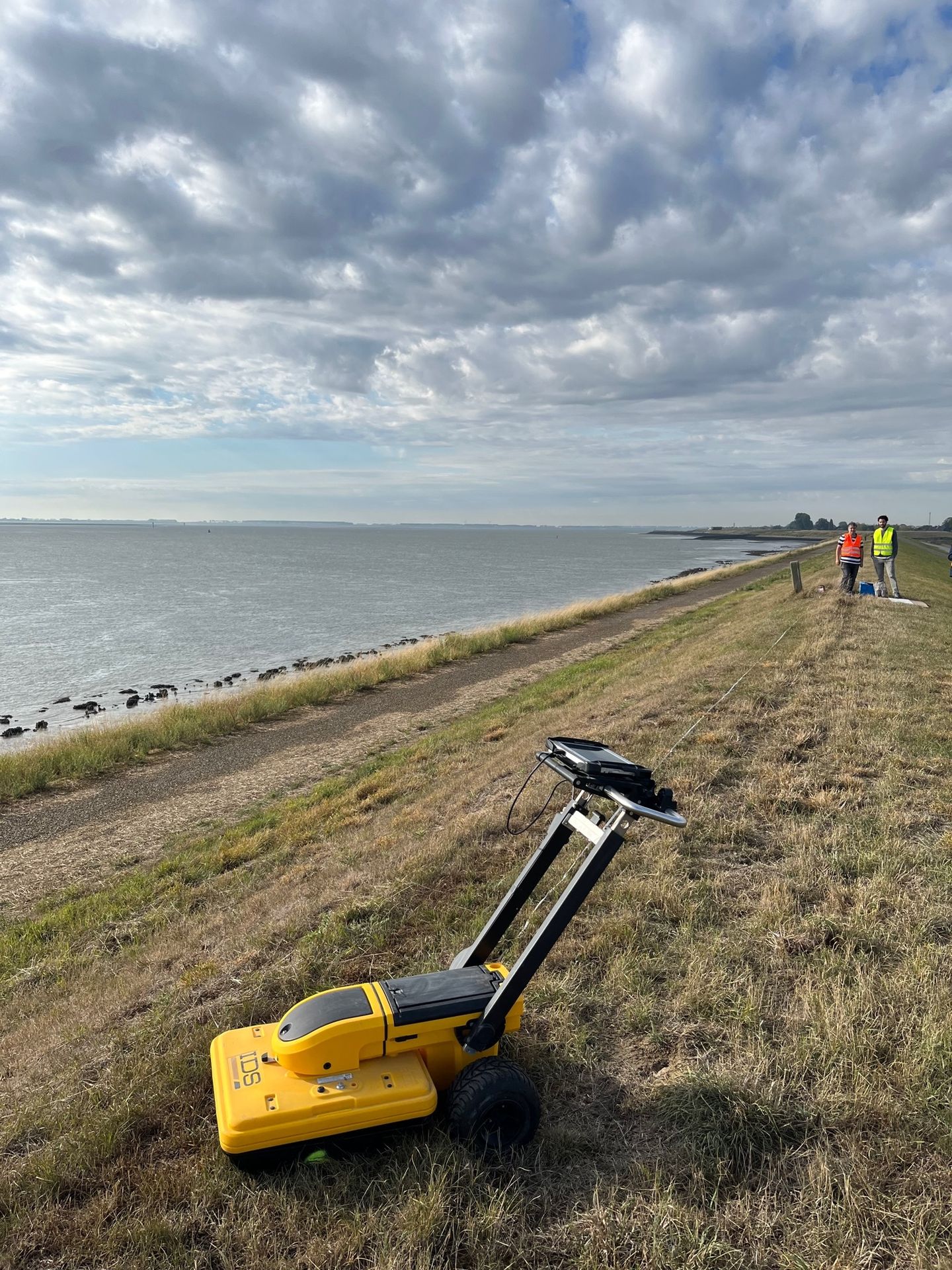
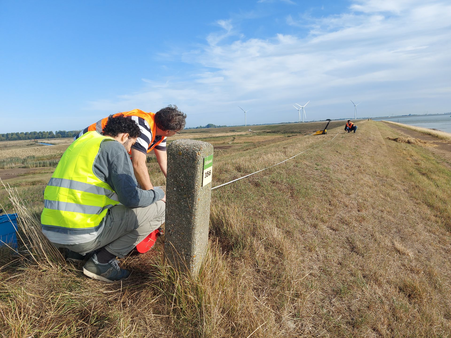
On September 10th, the BONSAI project took a step forward in addressing this challenge. A joint team from HZ University of Applied Sciences (Vana Tsimopoulou, Danny Janssen, and Borja Beltran Lopez) and the University of Lille (Khalil Lhamidi and Ammar Aljer) conducted Ground Penetrating Radar (GPR) scans at a levee in Hoedekenskerke, Zeeland.
The goal? To test whether GPR technology can effectively detect, inspect, and monitor animal activities—specifically mole burrow systems—within flood defense structures without or disturbing the animals or the dike.
How It
Works
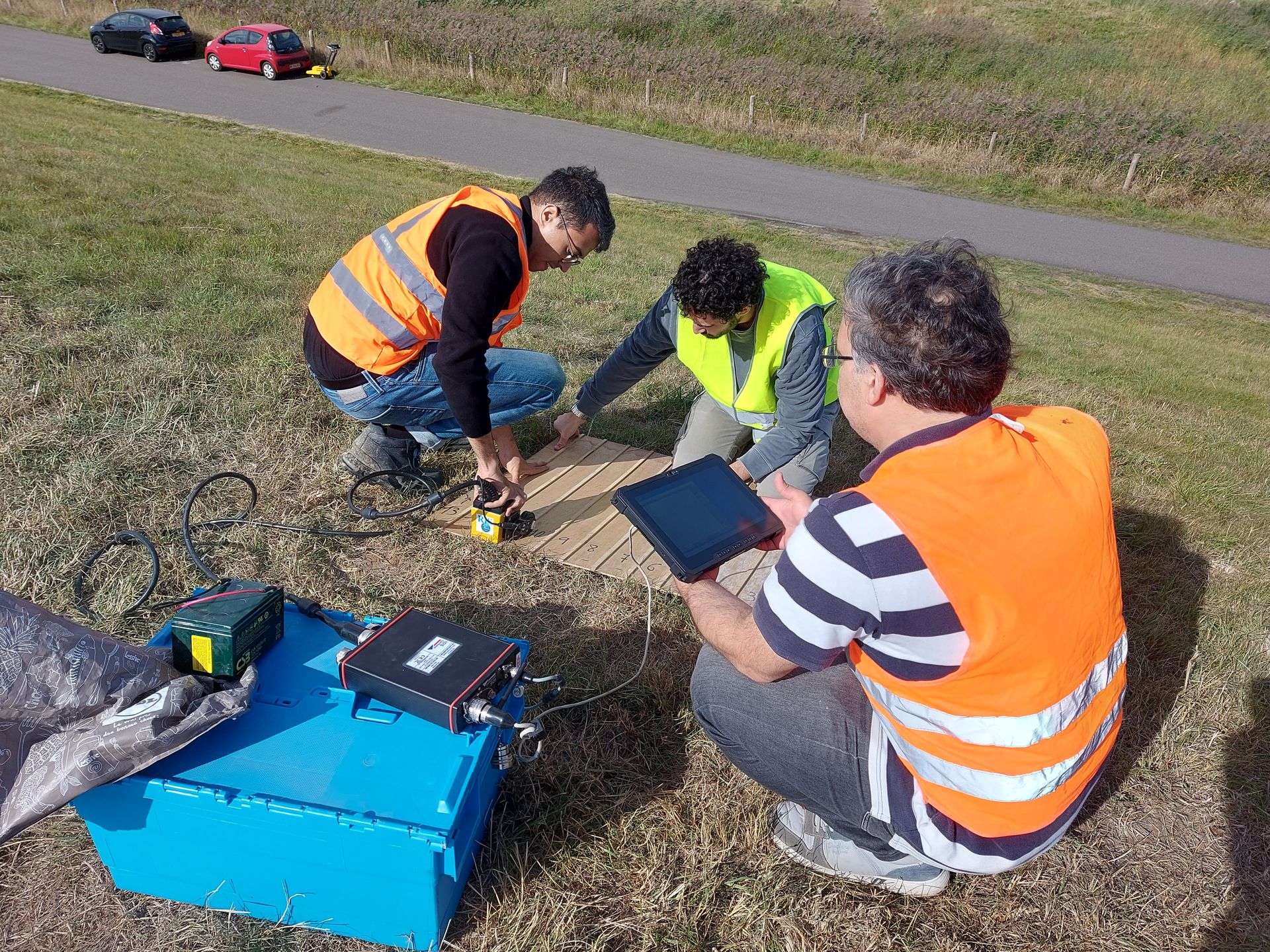
GPR uses electromagnetic waves to create images of what lies beneath the soil surface. During the field test, the team employed three different frequency configurations:
- 200 & 600 MHz: Used to scan longer stretches of the levee, providing deeper penetration (up to 3 meters) with less detail
- 3000 MHz: Applied to two 1x1 meter areas, generating highly detailed images of the top 60 cm of the dike structure
The choice
of frequency depends on various parameters, including soil moisture content,
making this a complex but crucial calibration process.
Promising Results
The initial on-site analysis revealed encouraging findings. The team successfully obtained 2D cross-sections of the electromagnetic spectrum of the soil surface, and importantly, they observed a clear correlation between the position of known mole burrows and variations in amplitude on the 2D images.
This correlation suggests that GPR technology could become a valuable tool for early detection of animal-induced weaknesses in flood defense systems.
Challenges and Next Steps
Working on the steep slopes of a dike (with a 1:3 gradient) presented its own challenges, though fortunately the weather cooperated for most of the day. The real work, however, continues in the lab.
The next phase involves deep analysis of the scan data, including transforming the 2D images into comprehensive 3D models. Additional measurements are being planned at other locations within the BONSAI project region, allowing researchers to compare results across different soil types and conditions.
These comparative studies will be crucial for developing numerical models that can estimate the reduction in dike strength caused by animal burrows—ultimately helping flood risk managers make better-informed decisions about inspection and maintenance priorities.
Part of a Bigger Picture
This GPR testing is part of BONSAI's Work Package 2, which focuses on animal activities as one of five critical challenges facing flood defense systems. Alongside erosion, biodiversity and vegetation, nature-based solutions, and disaster management, understanding and mitigating the effects of animal burrows is essential for building resilient flood defenses that can withstand the increasing pressures of climate change.
By combining cutting-edge technology with transnational cooperation, BONSAI continues to develop innovative solutions that will protect millions of people across Northwest Europe's vulnerable estuarine regions.